Atria
AtriaDescribe what you are looking for and Scout crawls every target jurisdiction, scores every parcel against your criteria, and hands back an IC-ready brief. The site selection cycle, compressed from quarters to an afternoon.
150M+
Parcels searchable
450+
Jurisdictions
< 30 min
Per jurisdiction crawl
0-100
AI fit score per parcel
Describe your acquisition criteria in plain language - acreage, zoning, infrastructure proximity, flood risk. Atria asks follow-ups and proposes a crawl before running.
Scout fetches the full parcel universe across every target jurisdiction at once - county GIS, city zoning, FEMA, infrastructure - and normalizes it into one dataset.
A multi-stage filter narrows the universe, then each survivor is AI-scored against your thesis. The strongest sites are ranked and explained, not just listed.
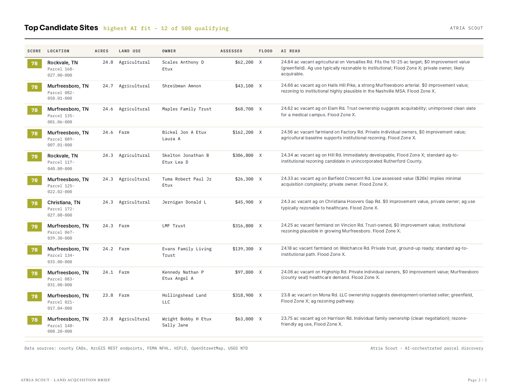
Every crawl assembles into a branded Land Acquisition Brief: the assessment funnel, the qualifying shortlist, and the reasoning behind each score.
Find better sites.
Describe your thesis. Atria asks clarifying questions, proposes a crawl, and lets you refine before running.
Data center sites, DFW region. 50+ acres, M-zoned, within 2 miles of a 230 kV transmission line, outside the 100-year floodplain.
→ 1,410 parcels crawled · 14 jurisdictions · 79 strong matches surfaced
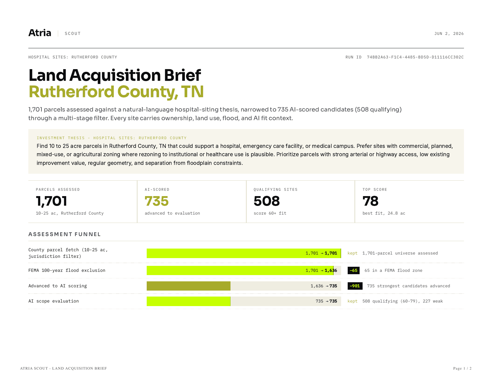
Every crawl shows its work - how many parcels entered, what each filter removed, and why the survivors qualified. No black box. This is a real run: hospital sites across Rutherford County, TN.
1,701
Parcel universe
1,636
Flood excluded
735
AI-scored
508
Qualifying
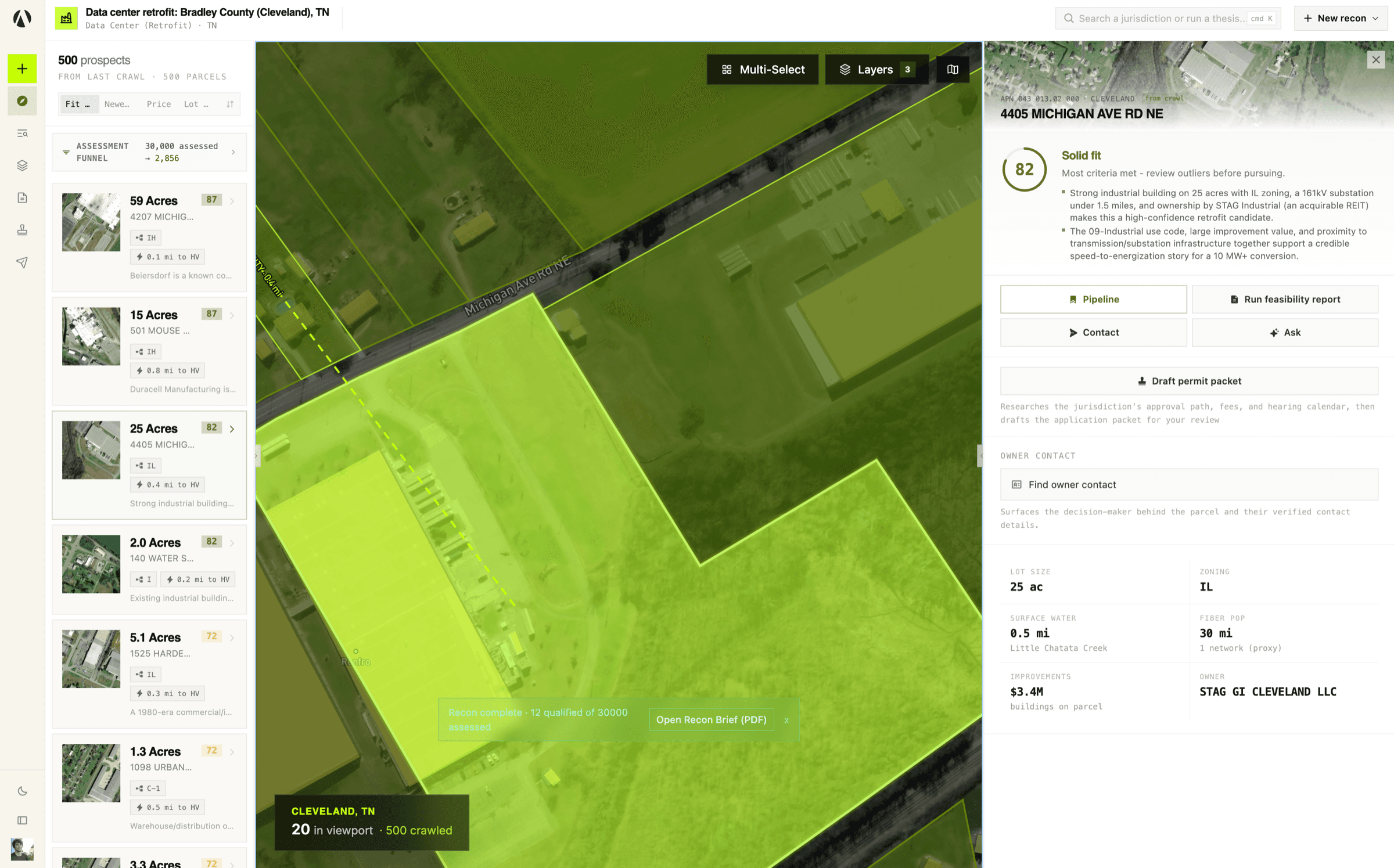
The same data layers your analysts would spend days stitching together, attached to every parcel and weighed in the score.
The assessment funnel, the qualifying shortlist ranked by AI fit, and the reasoning behind every score - assembled into a branded, export-ready PDF your committee can act on.